


Ladd Natural Bridge Nature Preserve
(Next to) 6984 Federal Rd., Cutler MAP IT
Donated to the state for preservation by the Ladd family in 1978, this natural bridge (formed by a waterfall) requires a permit to visit and a drive to the middle of nowhere and a hike to reach. But first, you have to find it!
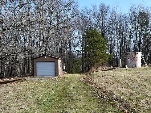
The best way to get there is to set your map to 6984 Federal Rd. in Cutler. This is a private residence, but the driveway directly to the south of the residence (which has no address) is the official parking lot for Ladd Natural Bridge Nature Preserve. After parking, just place your permit in your window and you’re ready to explore.
NOTE: Be forewarned that it requires driving on gravel roads to reach this location.
From the parking lot, follow the straight path into the woods and then follow the very well-maintained trail to your destination. The round-trip hike on Bridge Trail is less than a mile and a half and not particularly difficult.
Although not as large as Rock Bridge, Ladd Natural Bridge is still impressive, and the seclusion and challenge of reaching it, and the peace and quiet in the area, make it all worthwhile.
Interestingly, Snyder and other geologists believe that the remains of another fallen natural arch lie at the base of Ladd Natural Bridge, where several large slump blocks lying in a line across the narrow valley may be the remains of a second natural arch that once existed beneath the present one. This would have been an impressive double bridge!


Miller Nature Sanctuary - Natural Bridge & Arch
13654 Barrett Mill Rd., Bainbridge MAP IT
Miller Nature Sanctuary contains both a natural bridge and an impressive arch and is located in a predominantly Amish area, and right next to Rocky Fork Gorge.
The modest 86-acre park surrounds Rocky Fork Creek, which itself is known for its deep gorges and interesting rock formations. It contains only a few miles of hiking trails, most of which transverse the top and bottom of the river valley. The trail system first leads past the natural bridge (the least remarkable on this tour, but nonetheless interesting), and then past the arch, which is unique and somewhat resembles the kind of arches you encounter in Utah and out west.
There are also several waterfalls and numerous opportunities to explore the river banks and large slump rocks that line the stream.
This area is known to have some of the best spring wildflower displays in Ohio, not to mention a bunch of other nearby attractions, providing yet another reason to visit. (NOTE: You can kayak this area, too. LEARN MORE)


Irish Run Natural Bridge
T411, Matamoras MAP IT
The most challenging natural bridge to reach on this list (and certainly the most remote) is Irish Run. The 51 foot long, 19 foot wide and 16 foot thick bridge is located on public land in Wayne National Forest, not far from the Ohio River and West Virginia.
Although hiking is the preferred method to reach the bridge (and accessible from the Arches Fork Trailhead), it is possible to drive and park close to the destination on County Road T411—the same road as the trailhead. However, because of the remoteness of this area, you’ll want to have the directions plugged into your phone/car while you still have reception. Otherwise, it will be hard to find. Also, you’ll be required to cross a concrete bridge that may or may not have a small trickle of a creek running over it. If the U.S. Forest Service has the road and bridge shut down, do not try to cross it!
Using your online map to track the location of the natural bridge on T411, when you get near the location, look for a small gravel pullover next to the road where you can park. The bridge is about 300 feet into the woods, up a short hill.
If you love hiking, this deeply forested part of the state has hundreds of miles of trails to explore, including sections of the Buckeye Trail. Horseback riding, mountain biking and mud bogging are also popular activities. However, other than that, there’s really nothing else nearby!


